File:Fig8 Leroux Agri2018 8-6.png
Original file (3,604 × 2,000 pixels, file size: 2.88 MB, MIME type: image/png)
Summary
| Description |
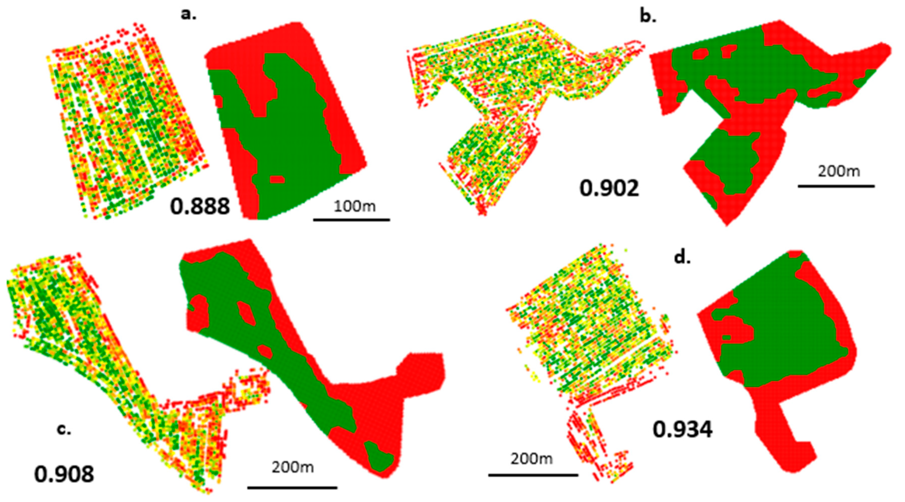
Figure 8. Ranking of the seven yield datasets in terms of the associated TOI value: (a) Field 1; (b) Field 2; (c) Field 3; (d) Field 4; (e) Field 5; (f) Field 6; (g) Field 7. Cleaned yield values and corresponding potential variable application maps are also displayed for each field. TOI: technical opportunity index |
|---|---|
| Source |
Leroux, C.; Jones, H.; Pichon, L.; Guillaume, S.; Lamour, J.; Taylor, J.; Naud, O.; Crestey, T.; Lablee, J.-L.; Tisseyre, B. (2018). "GeoFIS: An open-source decision support tool for precision agriculture data". Agriculture 8 (6): 73. doi:10.3390/agriculture8060073. |
| Date |
2018 |
| Author |
Leroux, C.; Jones, H.; Pichon, L.; Guillaume, S.; Lamour, J.; Taylor, J.; Naud, O.; Crestey, T.; Lablee, J.-L.; Tisseyre, B. |
| Permission (Reusing this file) |
|
| Other versions |
Licensing
|
|
This work is licensed under the Creative Commons Attribution 4.0 License. |
File history
Click on a date/time to view the file as it appeared at that time.
| Date/Time | Thumbnail | Dimensions | User | Comment | |
|---|---|---|---|---|---|
| current | 21:47, 10 July 2018 | | 3,604 × 2,000 (2.88 MB) | Shawndouglas (talk | contribs) |
You cannot overwrite this file.
File usage
The following page uses this file:


