Difference between revisions of "File:Fig13 Leroux Agri2018 8-6.png"
From LIMSWiki
Jump to navigationJump to searchShawndouglas (talk | contribs) |
Shawndouglas (talk | contribs) (Added summary.) |
||
| Line 1: | Line 1: | ||
==Summary== | |||
{{Information | |||
|Description='''Figure 13.''' Aggregated risk zones of sub-optimal management practices derived using the NDVI, EC<sub>a</sub>, and elevation layers together with local expert knowledge | |||
|Source={{cite journal |title=GeoFIS: An open-source decision support tool for precision agriculture data |journal=Agriculture |author=Leroux, C.; Jones, H.; Pichon, L.; Guillaume, S.; Lamour, J.; Taylor, J.; Naud, O.; Crestey, T.; Lablee, J.-L.; Tisseyre, B. |volume=8 |issue=6 |pages=73 |year=2018 |doi=10.3390/agriculture8060073}} | |||
|Author=Leroux, C.; Jones, H.; Pichon, L.; Guillaume, S.; Lamour, J.; Taylor, J.; Naud, O.; Crestey, T.; Lablee, J.-L.; Tisseyre, B. | |||
|Date=2018 | |||
|Permission=[http://creativecommons.org/licenses/by/4.0/ Creative Commons Attribution 4.0 International] | |||
}} | |||
== Licensing == | == Licensing == | ||
{{cc-by-4.0}} | {{cc-by-4.0}} | ||
Latest revision as of 22:48, 10 July 2018
Summary
| Description |
Figure 13. Aggregated risk zones of sub-optimal management practices derived using the NDVI, ECa, and elevation layers together with local expert knowledge |
|---|---|
| Source |
Leroux, C.; Jones, H.; Pichon, L.; Guillaume, S.; Lamour, J.; Taylor, J.; Naud, O.; Crestey, T.; Lablee, J.-L.; Tisseyre, B. (2018). "GeoFIS: An open-source decision support tool for precision agriculture data". Agriculture 8 (6): 73. doi:10.3390/agriculture8060073. |
| Date |
2018 |
| Author |
Leroux, C.; Jones, H.; Pichon, L.; Guillaume, S.; Lamour, J.; Taylor, J.; Naud, O.; Crestey, T.; Lablee, J.-L.; Tisseyre, B. |
| Permission (Reusing this file) |
|
| Other versions |
Licensing
|
|
This work is licensed under the Creative Commons Attribution 4.0 License. |
File history
Click on a date/time to view the file as it appeared at that time.
| Date/Time | Thumbnail | Dimensions | User | Comment | |
|---|---|---|---|---|---|
| current | 22:44, 10 July 2018 | 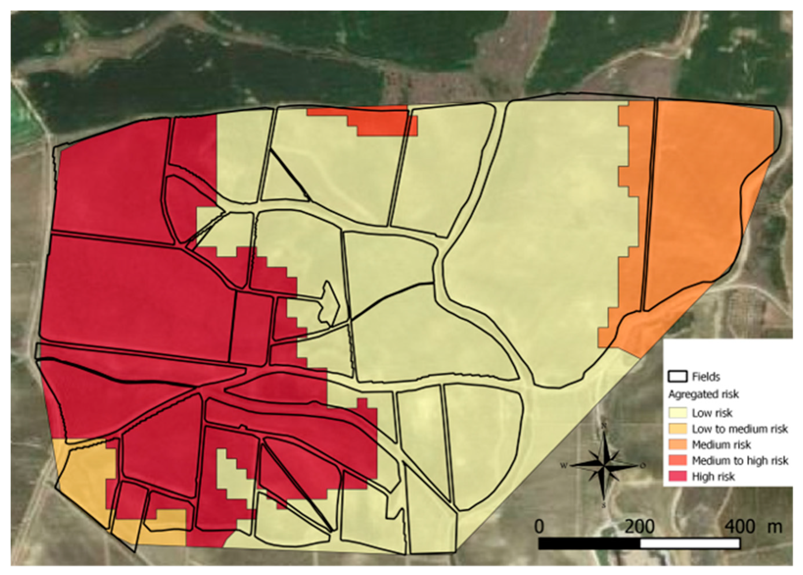 | 2,779 × 1,990 (2.93 MB) | Shawndouglas (talk | contribs) |
You cannot overwrite this file.
File usage
The following page uses this file:


